
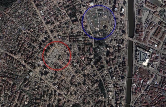
This satellite image, provided by the Ministry of Land, Infrastructure and Transport, shows quake-hit Turkey.
SEOUL, May 18 (Korea Bizwire) — The national land satellite imagery, developed using local technology, will be utilized globally for disaster and catastrophe relief.
The National Geographic Information Institute on Wednesday announced its partnership with the International Charter Space and Major Disasters during the Charter’s main conference last month.
The institute is now a “satellite owning and operating partner.”
The institute plans to commence full-scale operations later this year, following the completion of system integration measures required for related activities by the first half of this year.
The National Land Satellite No. 1, developed with local technology, has the capability to capture high-resolution images that clearly distinguish objects measuring 50 centimeters in both width and height from an altitude of 500 kilometers.
Since 2020, the Ministry of Land, Infrastructure and Transport has been providing the satellite-captured images to domestic municipal governments affected by significant disasters.
When an earthquake struck Turkey in February, the first satellite imagery was promptly provided for overseas disaster response.
Kevin Lee (kevinlee@koreabizwire.com)


