
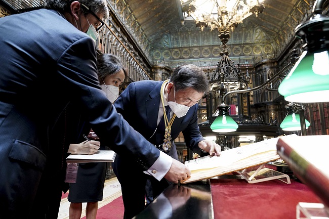
South Korean President Moon Jae-in (C) looks at the “Map of Joseon Kingdom” at the Spanish Senate Library in Madrid on June 16, 2021. (Yonhap)
MADRID/SEOUL, June 17 (Korea Bizwire) — South Korean President Moon Jae-in said a “very valuable” ancient map he witnessed in Madrid on Wednesday shows Dokdo is part of Korean territory.
Moon, now on a state visit to Spain, made the remarks after looking at the “Map of Joseon Kingdom” at the Spanish Senate Library, according to presidential spokesperson Park Kyung-mee.
Moon’s mention of Dokdo, the easternmost South Korean islets, came amid rising diplomatic conflict between South Korea and Japan over a map on the Tokyo Olympic website showing Dokdo as part of Japanese territory.
“It can be said that (Map of Joseon Kingdom) is a very valuable historical document that shows Dokdo is Korean territory,” Moon was quoted as saying during his visit to the library.
Moon, who arrived in Spain on Tuesday, visited the library after delivering a speech at the Spanish parliament.
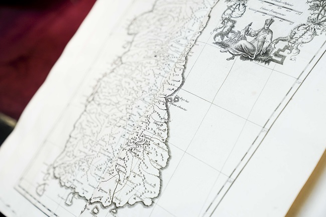
The “Map of Joseon Kingdom” held by the Spanish Senate Library in Madrid shows Dokdo as part of Korean territory. (Yonhap)
The “Map of Joseon Kingdom,” held by the Spanish library, is part of ancient maps of the Qing Empire produced by French geographer and cartographer Jean-Baptiste Bourguignon d’Anville in the 18th century.
The map seen by Moon is known to be the oldest extant map of the Joseon Dynasty (1392-1910) made by Westerners. It shows that Dokdo is part of Joseon territory.
Place names in the map were marked with Chinese pronunciation, and Dokdo is written as “Tchian Chan Tao” apparently because Dokdo’s name at the time, Usando, was confused with Cheonsando, the presidential office Cheong Wa Dae explained.
The chief of the Spanish Senate Library explained the value of the map to Moon, saying that it is a map of the Korean Peninsula in the 1730s and he thinks it may be the most touching record for Koreans.
Moon took a close look at the map after taking off his glasses and expressed gratitude for being shown very valuable material.
South Korea has maintained a small Coast Guard unit on Dokdo since 1954 in a show of its effective control of the East Sea islets, but Japan has claimed sovereignty over the territory, which is rich in fish and hydrate gas.
(Joint Press Corps-Yonhap)


