
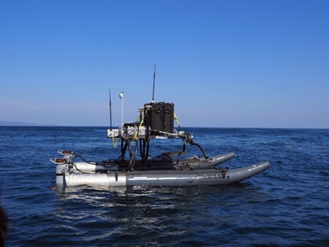
A team of researchers led by Shin Dong-hyeok remotely controlled the unmanned ship equipped with a multibeam echo sounder to check underwater features in relatively shallow waters, according to the Korea Institute of Ocean Science and Technology (KIOST). (Image: KIOST)
BUSAN, April 1 (Korea Bizwire) – South Korea’s state-run maritime institute said Friday it has successfully used an unmanned vessel to observe underwater topography close to shore.
A team of researchers led by Shin Dong-hyeok remotely controlled the unmanned ship equipped with a multibeam echo sounder to check underwater features in relatively shallow waters, according to the Korea Institute of Ocean Science and Technology (KIOST).
The institute said the latest measure is meaningful since large science vessels with the right equipment usually cannot approach the shoreline to check the topography close to the coast.
The KIOST said it plans to use the technology for seabed mapping of various islands surrounding the Korean Peninsula, including the eastern islets of Dokdo.
(Yonhap)


