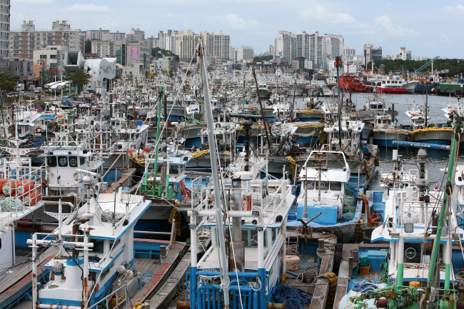
Fishing boats are moored at a port in South Korea’s southeastern city of Pohang on Sept. 20, 2019, as Typhoon Tapah is forecast to affect the southern parts of the country over the weekend. (Yonhap)
SEOUL, Sept. 20 (Korea Bizwire) — The southern parts of the nation could sustain significant damage as a typhoon is expected to pass nearby over the weekend, the state-run weather agency said Friday.
Typhoon Tapah, this year’s 17th, took shape 470 kilometers south of Japan’s Okinawa in the western Pacific Ocean the previous day and is currently tracking northward, the Korea Meteorological Administration said.
As of 3 p.m., the typhoon’s central pressure was 980 hectopascals and the maximum wind speed at its center was 104 kilometers per hour, with a wind radius of 330 kilometers, the agency said.
The figures were all up from the previous day, it added.
“Typhoon Tapah was moving west-northwest on seas 380 kilometers south-southwest of Okinawa at a speed of 2 kilometers per hour,” the agency said.
The typhoon gained force overnight as it stayed on high-temperature seas due to its slowdown.
The typhoon is forecast to reach seas some 80 kilometers southeast of the country’s southern island of Jeju at 3 p.m. Sunday and then some 30 kilometers southeast of the southeastern port city of Busan at 10 p.m. on the same day before moving toward the East Sea, the agency said.
In particular, the typhoon is feared to develop into a medium-level one when it nears the Korean Peninsula.
It is forecast to be strongest at 3 a.m. Sunday, with a maximum wind speed at its center reaching 133 kilometers per hour, according to the agency.
The typhoon is also likely to bring downpours of up to 150-400 millimeters to Jeju and 100-300 mm to South Jeolla and Gyeongsang provinces and Dokdo between Saturday and Monday.
(Yonhap)


