
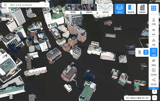
SEOUL, April 2 (Korea Bizwire) — The Seoul Metropolitan Government launched the operation of the ‘Digital Twin Seoul S-Map’ on Thursday.
The map is designed to be used in the simulation of solving urban problems by connecting a three-dimensional citywide map with administrative and environmental information.
This map enables a 3D simulation to figure out the course of the wind depending on the terrestrial environment and the impact of terrain features. This information can be used for the arrangement of buildings in urban planning.
The city government plans to use the S-Map in the decision-making process of its seven sub-committees, including the Traffic Impact Assessment Committee, as part of efforts to make assessment more objective and scientific.
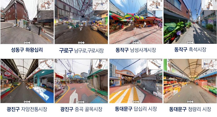
The S-Map will also be used when fires occur to assess the risk of damage to other buildings. In addition, the S-Map will provide about 14,000 street views, including traditional markets and small alleys that are not covered by private portals.
Image Credit: Seoul Metropolitan Government / photonews@koreabizwire.com


